Geological Applications for the EU: just a click away
The Geological Service for Europe Project aims to establish a sustainable organisation (GSE) from 2027 that will provide European institutions, academia, research organisations, national and regional policymakers, industry and citizens with up-to-date, high-quality EU/national level aggregated geoscientific information and advice about sustainable use and management of the subsurface.
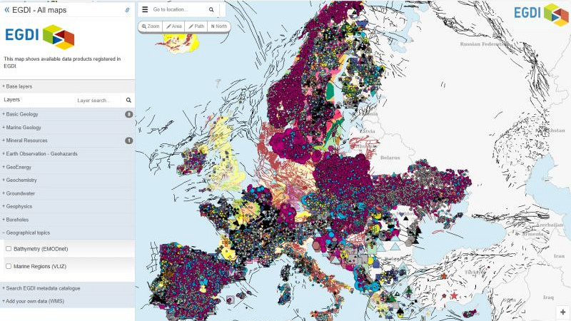
At the heart of a GSE is and will be the European Geological Data Infrastructure (EGDI). EGDI provides access to Pan-European and national geological datasets, tools, training and services from the Geological Survey Organisations of Europe. EGDI gives access to more than 800 map layers as well as numerous documents (reports, images, spreadsheets, etc.). The layers can be shown on maps and all the information can be searched in a free text search system.
During the GSEU Project, new components will be implemented and developed in EGDI to meet the needs of scientific users, and support research in specific areas of expertise for decision support, visualisation, Big Data approaches and the enhancement of a comprehensive Linked Data knowledge base. In addition, the IT infrastructure will be consolidated and developed to be highly scalable. The improvement of existing repositories, search system and semantic web technologies will facilitate the transition from data store to knowledge infrastructure.
Bring your own laptop to our sessions and try out EGDI for yourselves.


